Keith Roberts is one of the great historians of the Essex/Middle River area. Here is an article he wrote about how local places received their names.
What’s in a Name in Essex-Middle River?
Patch traces the history of many of the names of roads, schools and communities in the area.
By Keith Roberts (Essex Patch, 3/11/2011)
We drive our cars on them. Our homes are located within them. We do our shopping at them. We get our educations in them. We even swim, boat, fish, and crab in them.
However, I wonder how many of us ever question how our streets, communities, businesses, schools, or waterways got their names?
The single largest contributor of name origins in the Essex-Middle River area would undoubtedly be linked to Glenn L. Martin and the aircraft manufacturing company he founded here in 1929.
The communities of Aero Acres, Victory Villa, and Mars Estates were created to house the large numbers of employees at Martin’s during World War II, and their names reflect the spirit of the times or are associated with Martin’s aircraft. Even the streets of those areas honor the aircraft industry. Left Wing Drive, Altimeter Court, Doolittle Road, Compass Road, Rickenbacker Road, Orville Road, Martin Boulevard, Compression Court and more are all named after airplane parts or industry icons.
Martin Boulevard Elementary School and Glenmar Elementary School are both names that can be attributed to Glenn L. Martin. Shopping Centers such as Martin Plaza are named after Mr. Martin, and Mars Supermarkets take their name from one of the more famous airplanes produced at Martin’s. Even some waterways are unofficially titled after Martin such as Martin’s Lagoon.
Yet chronologically speaking, these names are mere infants in their birth. Many of the names in our area can be traced back to colonial and pre-colonial times. Let’s take a closer glance at some of these.
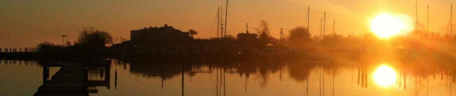
First, let us look at some of the waterways we have. During early exploration of Maryland, the Gunpowder River was thought to have many branches. The so-called Back Branch and Middle Branch of the Gunpowder were eventually found to be unattached to the Gunpowder and their names were changed to Back River and Middle River.
Long’s Creek that separates Rocky Point Park from Rocky Point Golf Course was named after Maj. Thomas Long (the first High Sheriff of Baltimore County) who had large land holdings in the area during the late 1600’s.
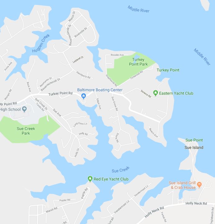
Sue Creek (originally Sue’s Creek) and Sue Island in Middle River are said to have been named in honor of a young girl who drowned there in colonial times.
Galloway Creek, also in Middle River is named after the family of Moses Galloway. According to an article that appeared in the June 13, 1918 issue of the Baltimore American, Galloway had a substantial home near the creek in the 1700’s. Moses died in 1790 and is buried in the family plot along with his wife who died in 1818.
The name Seneca Creek more than likely comes from an early land grant near that location entitled Sineca Ridge and dated 1678.
Stansbury Creek can accredit its name origin to members of the Stansbury family (one of the County’s pioneering families) who obtained some early land grants in that area.
Next, we examine the origins of names of some of the communities or land areas that are familiar. The community of Cherry Garden in the lower Back River Neck can probably trace its name to a land grant from 1674 called Cheney’s Garden. The name Cherry Garden (which is probably a corruption of Cheney’s Garden) first appears in a debt book belonging to a Mr. John Gardner and date 1754.
The name Bowleys Quarters comes from Merchant and Sea Captain Daniel Bowley who owned about 2,000 acres of land in that vicinity during the 1800’s. Capt. Bowley was the owner of many slaves who were housed or “quartered” on the land, hence the name Bowleys Quarters.
Wilson Point was originally called Bull Neck Point. The named was changed to Wilson Point more than likely in honor of Wilson Townsend, a prominent county businessman and community leader who had vast land holdings on the point in the mid to late 1800’s.
A gentleman by the name of Robert Benger obtained a grant for 59 acres in 1673 and called it Benger’s Addition. Over the years, the name either was corrupted or misspelled thus giving birth to the community of Bengies.
Hart Island (now part of the Hart-Miller Containment area) was originally called Hoopers Island. The name was changed in 1821 when the island was purchased by Joseph Hart.
I hope that sheds a little light on how some names in our community came about. As I am always looking for historic information, if you see a name missing from the above column and you have some facts you would like to provide, please contact me at Lkeithroberts@gmail.com.
Next week in honor of Women’s History Month, we will look at some pioneering women of Essex-Middle River. Keep reading EssexPatch.com